One climate change strategy communities are turning to is flood walls. Alton, Illinois extends uphill from the banks of the the Mississippi River. It experienced extreme flooding in 2016, 2018 and last year.
“[It was at] higher levels for longer amounts of time than in previous years,” said Brett Stawar, president of the Great Rivers & Routes Tourism Bureau, a regional tourism association based in Alton.
Alton has protected its downtown with a temporary floodwall. The wall can be raised as high as 8 feet. “The wall is made from an innovative process, working with concrete Jersey barriers, tarp, and the talent of the Alton Department of Public Works,” said Stawar.
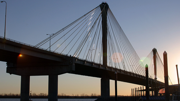
Clark Bridge seen from the Alton Marina. Illinois2011
Stawar said the region in which Alton lies has sometimes experienced 8 to 10 inches of rain in five-hour periods. “Our storm systems get inundated and take a while to drain,” said Stawar.
One of the biggest concerns is flooding on the Clark Bridge, a cable-stayed bridge between Alton and West Alton.
“The lower bridge access lanes get severely flooded so the 4 to 6-lane bridge goes down to 2 lanes. The Missouri Department of Transportation is currently exploring ways to raise the level of the roadway to the bridge,” said Stawar.
Stawar said the completion date of the interstate fix is several years away. Addressing flooding on the bridge will not solve Alton’s flooding issues. Yet this solution will provide access to Alton during intense storms. ♦
Jessica Zimmer is a freelance writer based in California.